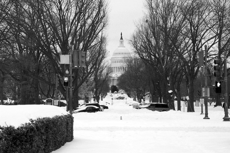
That's how much snow covers Washington, D.C., right now:
A major storm that broke all records for a December snowfall buried the Washington area Saturday, forcing authorities to suspend public transportation, declare a state of emergency and plead with residents to stay home.
Hundreds of airline flights were canceled, Metro stopped running trains to aboveground stations and shopping malls closed early because few customers could navigate treacherous roads to get there on the last weekend before Christmas.
But at 10 p.m. Saturday, it appeared that the fury of the great storm might be fading into flurries. Over the next two hours, "any additional accumulation will be light," the National Weather Service said.
Yet, it will be days before things return to normal. Metro said the suspension of bus and aboveground rail service, which went into effect Saturday, would continue Sunday morning when the system reopened.
At the snowstorm's peak in the afternoon, flakes fell at the rate of two inches an hour. Some areas, particularly in Southern Maryland, experienced wind gusts up to 64 km/h. The total measured snowfall at Reagan Airport at 8:58 p.m. was 41.4 cm, but it was as high as 58 cm elsewhere in the region. That would be more snow in a 24-hour period than the region typically gets in an entire winter. According to Weather Service statistics, the storm ranked among the biggest snowfalls in local history.
National Airport has reopened, which is helpful because in half an hour I'm heading over to O'Hare to get there. Diane and Parker stayed another night in Petersburg, Va.; we all hope they get up to Washington by the time my flight arrives. I-95 looks clear on the many traffic cameras set up along the way, but the streets inside the District may not be.
What fun. It was going to be a quick long weekend trip, too...
Yesterday I mentioned how helpful American Airlines was helping me avoid what promised to be an excruciating layover at O'Hare today. It turns out, Washington's weather is worse than even the most pessimistic forecasts:
A snowstorm of historic proportions is burying a wide swath of the Mid-Atlantic under as much as 30 to 90 cm of snow as the weekend gets underway. The Washington D.C. area is to end up among the locations hardest hit with as much as 60 cm of snow a possibility -- the heaviest accumulation to hit the nation's capital in at least six years and enough to grant the windy, rapidly intensifying system a spot among that city's Top 3 biggest snowstorms. Washington snow records date back to 1885.
It could be worse. We could be in Alaska, for example:
With all the snow in the Lower 48, it should be noted the port city of Valdez in southern Alaska has been hit with one of its heaviest weekly snow tallies ever. Snow began falling Monday and by Wednesday had totaled 1.7 m.... Additional spells of snow boost had boosted tallies to 2 m as Friday ended.
The phrase "heaviest in the last six years" refers to the February 2003 monster that stranded me in D.C. for two days:
Unfortunately, Parker and Diane are caught up in all this. They left last night for Washington to meet me there (I had to fly there because of airline fare rules, believe it or not), but only got as far as Petersburg, Va.. He seems comfortable enough, but I think he needs to get OFF THE BED. NOW.

So, I get an unexpected night in Chicago tonight, and they (I hope) get to drive up to D.C. in daylight without snowplows terrorizing them. They might have to stay in central Virginia another night, though. The forecast for D.C. doesn't look encouraging:
Today: Snow. The snow could be heavy at times. High near 29. North wind around 18 mph. Chance of precipitation is 100%. Total daytime snow accumulation of 8 to 12 inches possible.
Tonight: Snow, mainly before 4am. The snow could be heavy at times. Low around 27. North wind between 14 and 16 mph. Chance of precipitation is 90%. New snow accumulation of 2 to 4 inches possible.
Sunday: A chance of snow, mainly before 7am. Mostly cloudy, with a high near 33. Northwest wind around 15 mph. Chance of precipitation is 30%. New snow accumulation of less than a half inch possible.
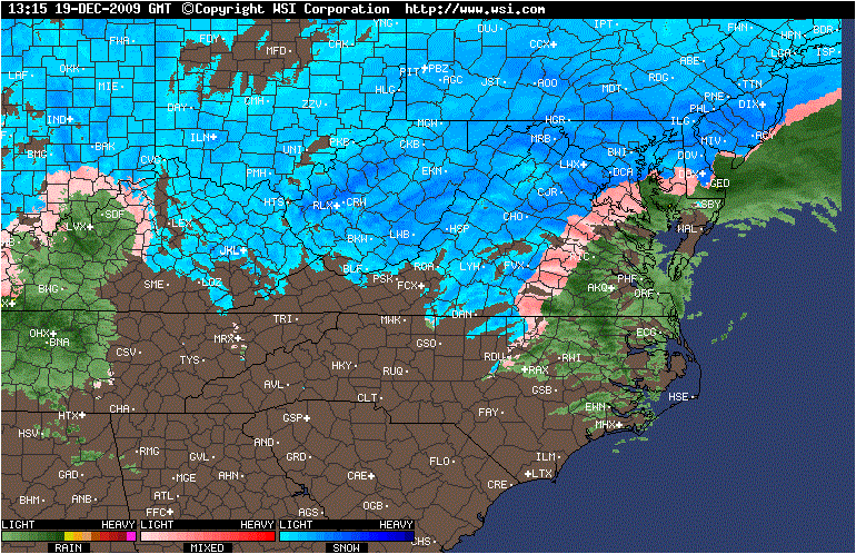
Nor does the radar image:
I hope that Virginia finds all (dozen) of its snowplows, and I hope Diane and Parker make it safely and quickly to D.C.
Original plan: Fly to Chicago tomorrow, then change at O'Hare for D.C. New plan: Fly to Chicago tomorrow, twiddle my thumbs at home, and fly to D.C. Sunday morning. Why? Because no one is flying to D.C. tomorrow:
The National Weather Service has issued a Winter Storm Warning for the entire [Washington] area, starting midnight Friday and lasting through 6 a.m. Sunday.
ABC 7 Meteorologist Chris Naille says the most of the region can expect 10 to 15 inches of snow, with up to 20 inches in spots along and east of I-95.
Parts of western and central Virginia could get up to 18 inches.
What fun. Fortunately, American Airlines has already gone into emergency mode, so when I called to see what my options were, they said "any plane Sunday."
So, I'll see everyone on Sunday.
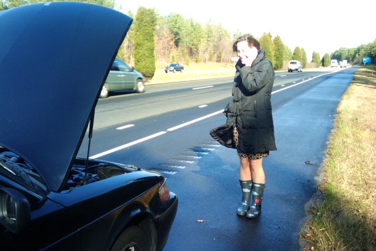
We got to Raleigh in one piece through a billion liters of rain, it seemed. Then this morning we got right back in the car to rescue one of our hosts after her radiator blew a hose:
We also got out of Chicago just ahead of the bone-chilling cold and snow that has started to make living there a true test of character. I love Chicago, but you know, sometimes, it's not bad to skip out for a little while.
Chicago woke up to 25 mm or snow of fluffy snow this morning, our first measurable snowfall of the year:
We don't mind this kind of snow. It took about 30 seconds to brush it off my car, the streets got cleared before sunrise—nothing heinous. No, "heinous" describes the forecast starting tomorrow night:
Tuesday Night: Snow before midnight, then rain, snow, and sleet. Low around -1°C. Breezy, with an east wind 30 to 35 km/h becoming southwest. Winds could gust as high as 45 km/h. Chance of precipitation is 100%.
Wednesday: Snow. High near 2°C. Breezy, with a west southwest wind between 25 and 35 km/h, with gusts as high as 65 km/h. Chance of precipitation is 80%.
Wednesday Night: A 20 percent chance of snow before midnight. Mostly cloudy and breezy, with a low around -12°C.
Thursday: Mostly sunny, with a high near -7°C.
Thursday Night: Partly cloudy, with a low around -16°C.
The best part about this forecast? I won't be in Chicago. I'll be in North Carolina working on a project, and there it will be 21°C on Wednesday.
Don't get me wrong—Chicago is the greatest city in North America. But you know, just this year, maybe I don't need to build more character?
Just a few quick things today:
- The temperature hit 13°C today, not a record but definitely a pleasant day in December. In Chicago. Because, of course, there are parts of the world where that temperature on any day of the year would cause alarm.
- Matthew Yglesias thinks mutual funds are stupid. I'm linking because of his two clear charts. His recommendations: index funds. (But...is any of this news?)
- The local pizza place around the corner folded last week. This was Parker's favorite summer hangout. We'll miss it.
- Comcast and AT&T are fighting public broadband in areas that don't have it. Common sense suggests that the government subsidy would ultimately go to them, but their first reaction is that of any monopolist. As Duke University economist Leslie Marx put it only yesterday, "remember that everywhere a firm looks, it is obligated to look for profits, and I would challenge anyone to show me an industry where the suppression of rivalry is not profitable."
More later. Possibly a Parker photo, too.
Chicago has had the longest streak of above-normal daily temperatures in any November since records have been kept:
The last day of November will see Chicago's 27th record-setting consecutive day with above-normal temperatures. Warmer readings are likely Tuesday as southwesterly winds and abundant sunshine allow afternoon high temperatures to approach and even exceed 50 degrees at many observation points around the metro area. A cold front should pass through Chicago early Wednesday, followed by a sudden turn to colder weather with falling temperatures.
In practice, this means that November felt like October, which, because of the 20 days of below-normal temperatures that month, felt like November. The forecast calls for a normal December, and who-knows-what in 2010.
Tomorrow we look forward to the correction: after the day's high of 11°C at midnight, a slow slide to -2°C before the snow pushes in on Wednesday. Yummy.
It looks like I might fly this afternoon:
I've had to postpone my annual flight review four times because of weather. Finally, today, the forecast calls for what you see above: clear skies, light winds, cold temperatures. (It's 0°C this morning.)
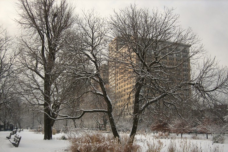
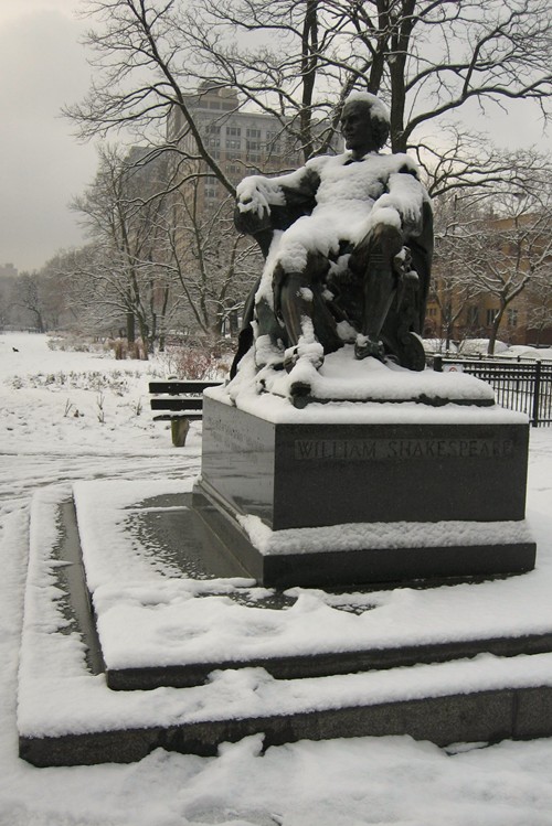
As usual, the primary color is gray:
There's a rumor we will have sunlight tomorrow. Unconfirmed.
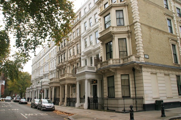
Remember how I mentioned packing for two out of the three climates I expected to encounter on this trip? I should note that I expected London to be warmer than Chicago. I also expected that I would only be outside in Chicago traveling from the O'Hare tram to my car, and my car to my apartment.
I'm debating finding a wollens store and buying a good, heavy, Scottish sweater.
Our next residency lets me do the same thing only moreso, when I get to go from Chicago to Delhi, India, at the end of January. At least I'll have a heavy coat, gloves, and a hat with me on the trip. One of my classmates mentioned how cold Delhi gets in winter, but I think she meant "relative to summer" and not "relative to what anyone else would consider cold."
This isn't a complaint, of course. In Chicago, if you complain about any temperature warmer than, say, -20°C, you're just whining. So I'm not complaining. I'm just acknowledging that I'm dressed inappropriately for the weather.
Bonus photo from half an hour ago. I'm definitely not in Dubai anymore: