National Public Radio has created an interactive map that uses Google Maps and new satellite images Google obtained yesterday to show 10-meter images of the Oklahoma tornado's destruction:
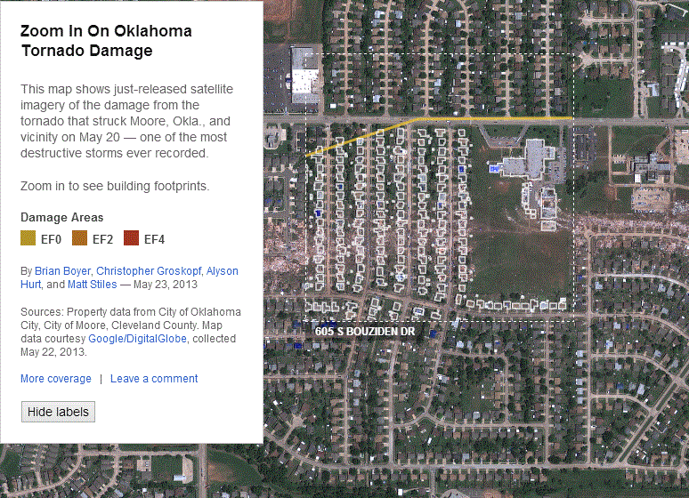
This may be the best, most timely use of geographic information in a news presentation I've ever seen.
The images are stunning. I can only imagine what life must be like in Moore right now—and with the NPR app, it's a lot easier to understand.
Copyright ©2026 Inner Drive Technology. Privacy. Donate!